
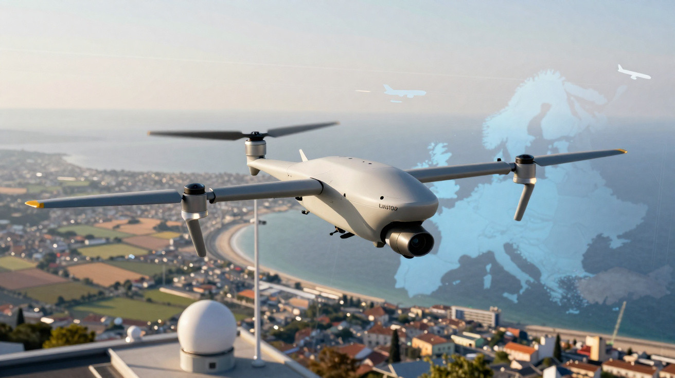
Between hangars and control rooms, a new class of unmanned aircraft is quietly starting to carve out space in Europe.
Most people still link drones to aerial filming or experimental deliveries. Yet aviation heavyweights are building far more discreet platforms designed to fly long distances for hours with minimal human input. In that strategically important niche, France’s Thales is readying the UAS100, its long-range drone system, with certification targeted for 2025.
A tireless “scout” for watching over long distances
The UAS100 is intended to fill a very specific operational gap: missions where helicopters are simply too expensive, ground patrols are slow and constrained, and satellites cannot provide imagery frequently enough. Maritime borders, lengthy frontiers, gas pipelines, power transmission lines and railways all sit squarely in that brief.
Rather than a small, noisy quadcopter with limited endurance, the UAS100 uses a fixed-wing layout and hybrid propulsion. The idea is straightforward: cover between 200 and 600 kilometres of linear infrastructure-depending on the variant-with stable, repeatable flights guided by data.
"The UAS100 is designed as a “persistent sensor”: it does not show up for a quick pass, it stays observing for as long as needed."
That persistence turns the drone into a territory-scale tool. It can track an anomaly, confirm whether a leak is worsening, see if a suspicious vessel changes course, or monitor whether a pocket of deforestation expands over several days.
The core challenge: decision autonomy, not just fuel
When people hear “long range”, they often think only about batteries, engines and aerodynamics. With the UAS100, the question goes deeper: who decides what during the flight?
The farther a drone travels from its operator and the more it flies beyond visual line of sight (BVLOS), the more it must be able to execute pre-programmed decisions-what to do if the link drops, if the wind shifts, or if airspace is unexpectedly closed.
Automation under strict oversight
Europe’s civil aviation authorities do not tolerate guesswork. To be certified, the drone’s automated behaviour has to be predictable, traceable and explainable. Every manoeuvre, emergency mode and alternate route must be documented and tested.
That includes loss-of-communication scenarios. The UAS100 must, for example, be able to:
- detect that the connection to the ground station has been interrupted;
- switch to a safe, pre-defined flight plan;
- avoid restricted areas and densely built-up urban zones;
- return to a holding point or carry out an automatic landing.
This degree of automation demands robust avionics-closer to what is used in certified aircraft-adapted for a lighter drone. That is precisely where Thales’ long track record as a supplier to civil and military aviation becomes a competitive advantage.
Europe closes the drones’ “Wild West”
In the early days, drone operations looked almost like a regulatory Wild West: rules varied by country, legal gaps were common and standardisation was limited. Since 2019, Europe’s landscape has shifted dramatically with the direct involvement of EASA (the European Union Aviation Safety Agency).
Today, higher-risk BVLOS operations follow the SORA methodology-a risk assessment process that evaluates ground and air risk and then defines the technical and operational measures required. The closer a drone flies to populated areas or routes used by manned aviation, the higher the safety bar.
"For manufacturers, this means thinking in terms of a “system of systems”: aircraft, ground station, communications, maintenance, training and risk management in a single coherent package."
The UAS100 has been developed exactly within that logic. It is not positioned merely as an air vehicle, but as a full solution, designed from the outset to match European certification and operational requirements.
UAS100: the system in detail
Thales presents the UAS100 as a family of fixed-wing drones, with variants already undergoing testing and larger models in preparation. The emphasis is on medium- and long-range missions, high automation and minimal staffing needs on the ground.
| Feature | Description |
|---|---|
| Drone type | Fixed wing with hybrid propulsion |
| Wingspan | 3.3 m (in testing) / 6.7 m (first flight planned) |
| Operational range | 200 to 600 km linear, depending on the version |
| Ground management | Operation with a single supervisor |
| Resilience | Navigation resilient to interference and complex electromagnetic environments |
| Data | Private cloud storage with a focus on security and integrity |
| Status | Flight tests under way, accreditation planned for 2025 |
The ground control station is designed around a single operator-supervisor. Pre-flight safety checks-weather, obstacles and airspace exclusion zones-are heavily automated, lowering the risk of human error.
Focus on real-world land and maritime missions
Thales is aiming at highly practical applications with fast payback for governments and businesses. The UAS100’s priority uses, as cited, include:
- coastal and land-border surveillance;
- support for security forces across large rural areas;
- inspection of gas and oil pipelines;
- monitoring of power transmission lines and railways;
- environmental observation in remote zones.
In these roles, the UAS100 is likely to cost less than a helicopter and to be more flexible than a satellite. The ability to repeat flights along the same route, at controlled frequencies and times, makes it easier to compare imagery and spot subtle anomalies-such as small temperature shifts, unusual movement or deformation in structures.
A market growing because the field demands predictability
Long-range drones are only one slice of the broader drone inspection and monitoring market, but they carry substantial strategic weight. Estimates cited by consultancies place this market moving from a little over US$15 billion in 2025 to around US$61 billion in 2035.
Demand is coming from multiple directions: energy utilities, infrastructure operators, environmental agencies, coastguards, police forces, and search-and-rescue services. They all face the same dilemma-how to watch vast areas regularly while budgets remain tight.
"The combination of regulatory pressure, the need to reduce costs and the requirement for reliable data tends to favour big players with an established aviation culture."
For start-ups that expanded during the industry’s freer phase, the environment becomes less welcoming. Certifying a complex BVLOS system in Europe takes time, a multidisciplinary team and funding that many young companies cannot sustain alone. The likely trend is consolidation around a handful of industrial groups, Thales among them.
Competitors and UAS100 positioning
The UAS100 is not entering an empty market. European manufacturers already operate fixed-wing drones, unmanned helicopters and hybrid platforms aimed at patrol, mapping and inspection missions.
| Player / system | Type | Main segment | Typical differentiator |
|---|---|---|---|
| Thales – UAS100 | Fixed wing, hybrid | Long range, surveillance and linear infrastructure | Focus on certification and integration with aeronautical standards |
| TEKEVER – AR5 | Fixed wing | Maritime patrol and extended missions | Strength in search and rescue at sea |
| Schiebel – CAMCOPTER S-100 | VTOL (helicopter-style) | Operation from ships and small areas | Advantage in vertical take-off and landing |
| Quantum Systems – Trinity | Fixed-wing eVTOL | Mapping and sensing | Emphasis on geospatial data capture |
Thales’ edge lies less in the aircraft’s shape and more in a “regulation-addressed system” proposition. From day one, the UAS100 is positioned as a tool built to fit Europe’s regulatory environment, which is particularly attractive to public agencies and major infrastructure operators.
Concepts that deserve a quick explanation
A few technical terms appear repeatedly when discussing the UAS100 and its rivals:
BVLOS (Beyond Visual Line of Sight) - describes operations where the drone flies beyond the pilot’s direct visual range. This requires reliable communications links, sensors for situational awareness, and detailed contingency plans.
SORA - a risk assessment methodology that helps regulators determine what level of technical and operational safety is required. A flight over isolated countryside, for instance, faces different requirements from a flight over a populated urban area.
Hybrid propulsion - a combination of an internal combustion engine and electric components, aiming to balance endurance and efficiency. For long-range drones, this architecture helps extend flight time without relying solely on heavy batteries.
Possible scenarios and the side effects of this advance
With a certified system like the UAS100 in service, governments and companies gain an unprecedented ability to monitor large areas in near real time. That can reduce pipeline fraud, undetected leaks, illegal fishing or trafficking across lightly patrolled border regions.
At the same time, debate grows around privacy, data transparency and the limits of using such capability for population surveillance. A drone that can fly for hours, record movement patterns and cross-reference information with other databases raises ethical questions that go far beyond the technology itself.
For maintenance, engineering and public-safety professionals, the spread of these systems opens up new lines of work: planning automated routes, interpreting captured data, managing cyber risk for ground stations, and even designing protocols for deliberate interference scenarios, such as attempted signal jamming.
The pace of accreditation through to 2025 will be a strong indicator of how much this “French aviation colossus” can shape the next phase of the long-range drone market-and how this new, quiet routine of aerial monitoring will fit into everyday life across European societies, and then other continents.




Comments
No comments yet. Be the first to comment!
Leave a Comment