
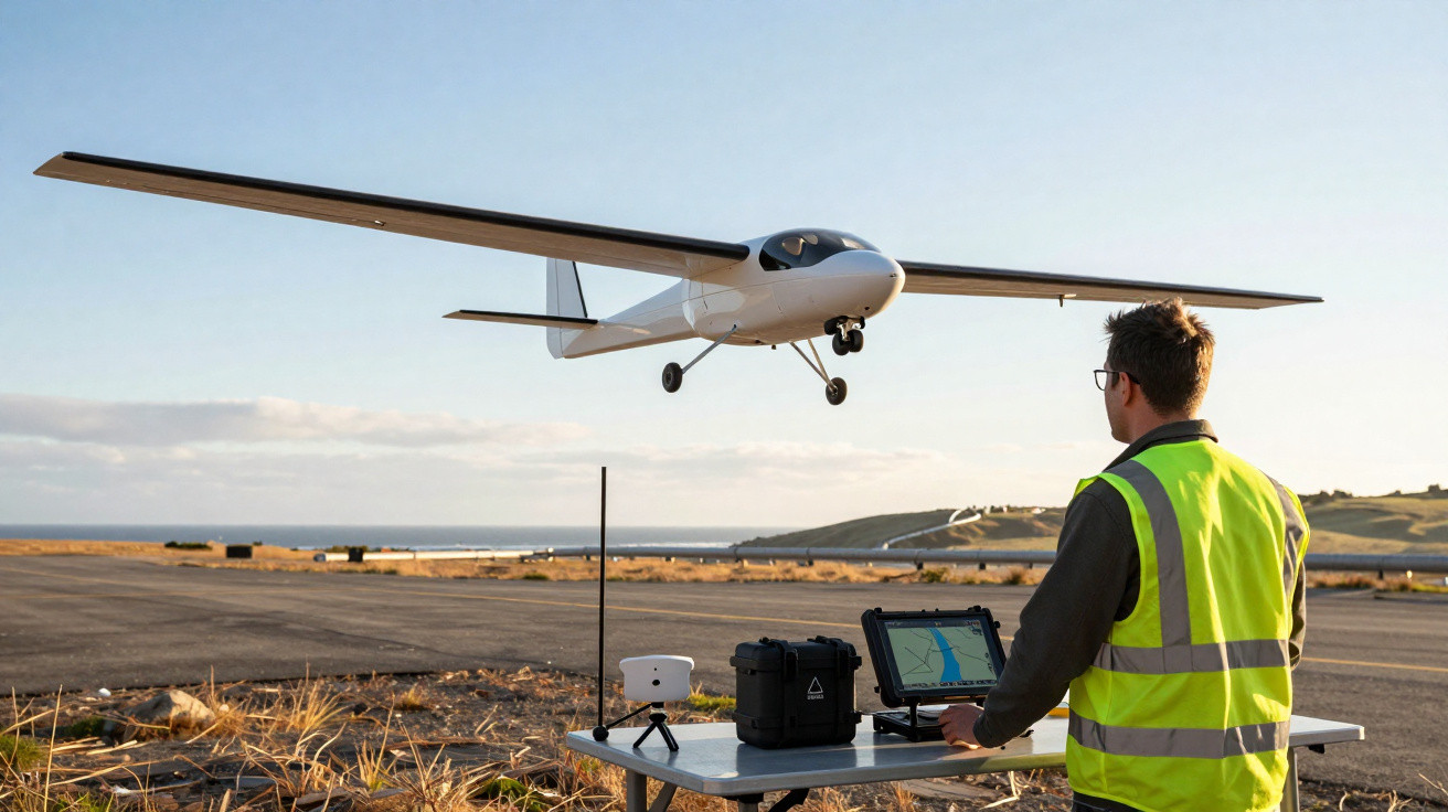
A low-key shift is unfolding along Europe’s shorelines and frontiers, taking place high above the dunes, pipelines and power lines.
Rather than relying on helicopters thundering overhead or patrol vehicles idling through long shifts, a new French-built long-range drone is being prepared to assume the repetitive, time-consuming flights that people find hard to deliver efficiently.
A patient scout rather than a flashy gadget
For a long time, coast guards, energy operators and border services have had to make do with tools that never quite fit the job. Patrols on the ground are slow and demand a lot of staff time. Helicopters deliver capability, but they are costly and loud. Satellites cover huge areas, yet only at fixed overpass times and can easily miss brief incidents.
Long-endurance drones aim to bridge that gap. They can remain airborne for hours, stick to planned routes and revisit the same locations repeatedly with sensors trained on the task. Thales’ UAS100 is designed precisely for this space.
The UAS100 is designed less as a showpiece and more as an untiring scout, flying hundreds of kilometres while streaming usable data.
These aircraft are nothing like the small quadcopters commonly seen over construction sites or sports grounds. The priority here is endurance and reach, not nimble manoeuvres. They lift off, climb to working altitude and then get on with the job: surveying, monitoring and inspecting.
Beyond visual line of sight: what makes these drones different
UAS100 sits in the BVLOS category - beyond visual line of sight. In practice, that means it is intended to operate well beyond an operator’s direct view, potentially hundreds of kilometres from where the crew is based.
The work is focused on practical, well-defined missions:
- Large-scale mapping and topography
- Inspection of power lines, railways and pipelines
- Border and coastal surveillance
- Environmental and wildlife monitoring
- Search-and-rescue support over land or sea
Across these use cases, the real benefit is dependable, repeatable imagery and sensor outputs, not a single dramatic capture. A team may need daily coverage of a section of coastline for months, or repeated checks of the same pipeline alignment after every major storm.
Autonomy becomes the real challenge
Who decides what: human vs machine
Endurance is not just about fuel or batteries. As distances increase, the key technical and legal pressure moves towards what the aircraft can do without continuous human input. At long range, constant joystick-style flying from the ground is simply not workable.
Instead, the aircraft needs to manage complex processes on its own: remaining within designated corridors, complying with no-fly areas, riding out temporary radio dropouts and adjusting to changing conditions. The person on the ground functions more like a supervisor than a traditional pilot.
Certification bodies now focus less on raw performance and more on predictable behaviour, traceable decisions and safe fallback modes.
This places a premium on dependable avionics, resilient navigation and software that reacts consistently when stressed. For Thales - rooted in certified aviation electronics - this is familiar territory.
Handling lost links and tough environments
A particularly delicate issue is losing communications. If the datalink fails, the drone must not wander into restricted airspace or behave unpredictably. It requires a clear decision ladder: continue on track, hold position, reroute, or return to base and land autonomously.
Thales states that UAS100 is protected against jamming and built to operate in electromagnetically “dirty” settings where interference is routine. Its navigation uses multiple inputs, so a GPS interruption does not automatically put the mission at risk.
A European rulebook that now has teeth
In the early phase of civil drone activity, regulation was often fragmented, with inconsistent rules and plenty of ambiguity. In Europe, that period is quickly ending. Since 2019, the European Union Aviation Safety Agency (EASA) has introduced a detailed structure covering certification, operations and training.
One central instrument is SORA - the Specific Operations Risk Assessment approach. It requires operators and manufacturers to assess risks both in the air and on the ground, and to define mitigation steps before any flight is approved.
The further and closer to sensitive zones a drone flies, the more its design must resemble conventional aviation in traceability, redundancy and documentation.
For groups such as Thales, the burden of regulation can be an advantage, favouring organisations accustomed to safety-critical engineering. It also makes life harder for start-ups that depend on rapid iteration and low-cost platforms.
UAS100: a system rather than a single aircraft
Hybrid fixed-wing architecture
Thales positions UAS100 as a “family” of hybrid-propulsion fixed-wing drones rather than a single model. Multiple test aircraft with a 3.3-metre wingspan are already flying, and a larger 6.7-metre variant is being readied for its maiden flight. Thales is aiming for full certification by the end of 2025.
| Feature | UAS100 description |
|---|---|
| Drone type | Fixed-wing with hybrid propulsion |
| Wingspan | 3.3 m (flight tests) / 6.7 m (upcoming) |
| Operational range | 200–600 km linear, depending on version |
| Autonomy | High, with pre-programmed automation and single-operator supervision |
| Navigation | Jamming-resistant, suited to complex electromagnetic environments |
| Ground station | Designed for one supervisor, real-time oversight |
| Data storage | Secured private cloud |
| Main uses | Coastal and border surveillance, law enforcement, linear infrastructure inspection |
| Status | Flight tests ongoing, certification targeted for 2025 |
The word “system” is central. UAS100 is not only the aircraft, but also the ground control station, the communications links and the secure cloud environment where information is delivered and processed. Even pre-flight safety checks are automated, covering weather, temporary restricted areas, obstacles and route validation before take-off.
Reduced crew and recurring missions
Staffing is a major part of the pitch. Thales says the drone can be overseen by a single supervisor at the ground station rather than a larger team, which is attractive for organisations under budget pressure and struggling to recruit.
Where the same task must be repeated - such as checking a specific power line corridor every week - the aircraft can fly stored routes with little need for re-planning. That shifts the operator’s attention towards interpreting images and sensor streams rather than manually flying the platform.
Field use: from coastlines to pipelines
Thales is not prioritising attention-grabbing showcases. Instead, it points to everyday but valuable work: coastline protection, land-border monitoring, support for police or gendarmerie over large rural regions, and the routine oversight of infrastructure stretching for kilometres.
Compared with a helicopter, a long-range drone offers longer loiter time at much lower operating cost, though with less immediate “on-scene” flexibility.
For a pipeline operator, a UAS100 sortie could cover hundreds of kilometres in a single run, identifying leaks, encroaching construction or indications of tampering. For a coastal service, the same platform could repeatedly patrol fishing zones, migration routes or pollution threats.
Satellites still play an important role in wide-area awareness, but a drone that can revisit the same segment multiple times in one day - flying lower and capturing higher-resolution detail - addresses a vital gap.
A market pulled by real-world demand
From niche to sizeable business
The worldwide market for drone inspection and monitoring is projected to grow from about $15.2 billion in 2025 to $61.5 billion in 2035. Long-range drones represent only one portion of that total, but it is a strategically significant one.
Demand is being driven by:
- Energy companies checking power and gas networks
- Transport operators monitoring rail and road corridors
- Coast guards and navies conducting maritime surveillance
- Civil protection agencies managing floods, fires or storms
- Environmental bodies tracking erosion, deforestation or wildlife
Meanwhile, European regulation is steering buyers towards platforms that look more like conventional aircraft in their safety culture. That generally advantages large industrial groups with extensive certification experience.
Facing rivals in a maturing sector
Thales is not the only contender. UAS100 will operate alongside systems such as TEKEVER’s AR5, Schiebel’s CAMCOPTER S-100 helicopter drone, and fixed-wing VTOL offerings from Quantum Systems or Wingtra, among others.
Different suppliers target different slices of the market. Some focus heavily on maritime patrol, integrating radar and maritime AIS receivers. Others concentrate on mapping aircraft for surveyors and construction teams. Thales is positioning itself around long, linear missions that blend civil requirements with security uses - where dependability and regulatory acceptance matter more than outright speed.
Key concepts and real-life scenarios
What BVLOS really means for airspace safety
BVLOS operations must coexist with other airspace users: light aircraft, helicopters and, in certain corridors, even commercial jets. Under EASA’s framework, operators have to define detect-and-avoid approaches, contingency routing and emergency landing plans.
For instance, during a coastal surveillance task, a UAS100 flight path could be limited to a narrow offshore corridor at an agreed altitude. If communications are lost, the aircraft might automatically climb or descend to a reserved level, fly a safe racetrack pattern and then return to base along a defined route.
Building these scenarios requires time and close coordination with national air navigation services, which helps explain why long-range civil drone operations tend to expand steadily rather than appearing overnight.
Benefits and risks for agencies and companies
For public bodies, the headline gain is persistence: long time on station without exhausting crews. A drone can also be dispatched quickly after a storm to examine damage along power lines, avoiding the need to send staff into areas that may still be hazardous.
The risks are less obvious. Too much dependence on automation can erode human skills, leaving teams less able to intervene manually when unusual situations arise. Data protection also becomes strategically important when sensitive imagery of borders, critical infrastructure or private land is stored and processed in digital systems, even when held within a private cloud.
Many organisations are moving towards mixed fleets. Short-range multirotors handle close-up local inspections. Long-range platforms such as UAS100 deliver wide-area coverage. Helicopters and crewed aircraft still remain essential for complex rescue work or tasks requiring immediate judgement on the scene.
As UAS100 moves towards its 2025 certification goal, the central issue is not only whether Thales delivers the aircraft, but how rapidly regulators, air traffic managers and end-users can adjust procedures to accommodate this additional layer of persistent, semi-autonomous observation in the sky.




Comments
No comments yet. Be the first to comment!
Leave a Comment