
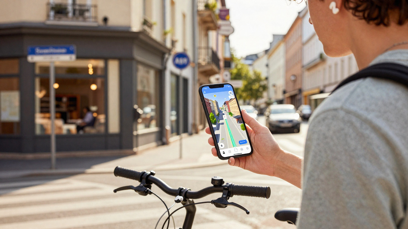
Millions of drivers around the world rely on this navigation app every day, and its next update is far more than a visual refresh. Google is bundling 3D guidance, see-through building rendering and a new AI assistant into one package designed to make driving calmer and the planning around it noticeably smarter.
Immersive Navigation: when the map suddenly feels three-dimensional
Until now, Maps may have looked polished, but at heart it was still a flat map. That is changing with the new “Immersive Navigation” feature. Route guidance is moving to a true 3D view that mirrors the real world far more closely than traditional road maps.
To do this, Google processes vast quantities of Street View imagery and aerial photography using its Gemini AI models. The result is a kind of digital streetscape that makes junctions, bridges, rows of buildings and even slight changes in elevation easier to read.
“Navigation gets closer to what the driver can already see – just earlier, clearer and without frantic glances over the shoulder.”
In future, Maps will show these elements much more clearly:
- individual lanes and turning lanes
- pedestrian crossings and traffic lights
- stop signs and other signage relevant to the journey
- distinctive buildings and bridges in 3D
When things get tricky, “Smart Zoom” steps in. The camera automatically zooms in on complicated junctions or motorway interchanges. At the same time, Maps can render building façades partly transparent so the driver can effectively see past tall rows of buildings-useful for spotting where the road continues or where the next exit appears.
More orientation, less cognitive load
The concept behind it is straightforward: reduce the mental effort drivers spend translating an abstract line into what they should do on the road. Previously you often had to work out whether that curve on the screen really meant the second exit or the third. The new view adds clear visual anchors to the map so drivers can orient themselves more naturally.
This more precise presentation can reduce stress especially in unfamiliar cities, complex motorway junctions or when driving at night. Anyone who already tenses up at roundabouts or closely spaced exits is likely to feel the difference from a more realistic view.
New voice guidance: instructions sound more like a passenger
Alongside the visuals, Google is also reworking the voice that talks you through traffic. Directions are meant to feel less technical and closer to the way a human passenger would speak.
Examples: rather than “Turn right in 300 metres,” you may hear guidance more like “Go past this exit and take the next one.” The wording is designed to lean more on recognisable points along the route and on the AI’s spatial “understanding”.
Behind the scenes, huge volumes of data are in play. Google talks about several million traffic updates per second and over ten million community reports per day. These include alerts about congestion, closed lanes, collisions, roadworks or flooded roads.
“The denser the real-time data, the more relevant the one route Maps ultimately recommends becomes.”
Regular commuters stand to gain the most: the app can react faster to sudden restrictions and suggest alternatives before you end up stuck in a queue.
Route choice with clearer trade-offs
Google Maps already offers multiple route options. With this update, the app puts the pros and cons of those alternatives much more front and centre. The aim is to help users make a deliberate decision between time, cost and comfort.
| Route type | Advantage | Disadvantage |
|---|---|---|
| Fastest route | Shortest travel time | Often tolls or higher consumption |
| Cheapest route | Fewer or no toll charges | Allow more time; sometimes heavier traffic |
| Smooth route | Steadier drive with fewer stop-start phases | Not always the shortest distance |
Previously, these details were often hidden away or only partially shown-for example, as a small note about tolls. Going forward, Maps is expected to surface these pointers directly in the route comparison. Users can more quickly judge whether a detour is genuinely worth it, or whether saving a few minutes does not justify the toll charges.
Ask Maps: an AI assistant for questions about places and routes
The second major part of the update is called “Ask Maps”. It is a conversational assistant built on Gemini models, and it is intended to handle far more complex requests than a standard search box.
Instead of only entering an address or asking for the nearest supermarket, you can ask things like:
- “Show me restaurants in Berlin that are open late, offer vegetarian options and are easy to reach by U-Bahn.”
- “Plan me an afternoon route in Vienna with two child-friendly stops and a café with Wi‑Fi.”
- “Where can I find parking in Munich so I can reach the stadium on foot in under ten minutes?”
The assistant does not just look at distance. It also considers opening hours, ratings, transport links, current busyness and other contextual factors. Results appear as suggestion lists or as pins placed directly on the map, and if you want, Maps then adjusts your route automatically.
“Ask Maps turns the map into a conversation partner that not only knows places, but also judges how practical they are for everyday life.”
For city breaks or business trips with a tight timetable, this kind of help can be the difference between a chaotic day and a structured one. The app will not only propose destinations; if you ask, it can also offer alternatives when somewhere is too busy, too far away or closed.
Where the AI gets its information
The foundation is Google Maps’ enormous data corpus: opening hours, user reviews, busy times, photos, traffic conditions and public transport connections. Gemini models link these signals together, spot patterns and produce answers that go beyond simple filtering.
For example, if someone asks for a quiet café to work from, the response can incorporate more than just mentions of sockets or Wi‑Fi. Busy times and typical footfall can also influence the recommendation-so the app can suggest places where getting a free table at lunchtime is genuinely likely.
When the new features are coming to Europe
Google is starting the rollout of the new features in the United States first. Other regions are expected to follow, but specific dates for German-speaking markets have not yet been confirmed. In practice, big updates like this usually take several weeks to months to roll out.
A staged release is likely. A typical pattern looks like this:
- First, some users see the new 3D view on selected routes.
- Ask Maps initially appears only in English.
- Additional languages follow later, alongside adapted traffic data and regional specifics.
Berlin, Hamburg, Munich, Vienna and Zurich are likely to receive more complete 3D models earlier, because these cities tend to have particularly rich Street View coverage and traffic datasets. Rural areas typically lag behind.
What changes in everyday use
For typical users in Germany, Austria or Switzerland, several concrete scenarios emerge:
- Commuters can see more clearly which lane they need at major interchanges and motorway junctions, reducing last-second lane changes.
- Holidaymakers in hire cars benefit from more visible reference points in unfamiliar cities, such as distinctive buildings rendered in 3D.
- Occasional drivers can use Ask Maps to put together simple weekend trips or restaurant evenings without running lots of separate searches.
At best, this reduces the number of stressful situations where you are simultaneously driving, interpreting the map and making rapid decisions. Younger or less confident drivers, in particular, may feel safer in complex traffic environments.
Opportunities and risks of AI navigation
More convenience also raises questions. If you lean heavily on visual and spoken prompts, you may pay less attention to real-world signs and road markings. Reliable AI navigation should not replace looking at the road; it should only support it.
There are also privacy considerations: the more intensely Ask Maps is used, the easier it becomes to infer movement patterns and interests. Users should keep in mind what location permissions they grant and what personalisation they allow.
On the plus side, planning becomes more predictable. Companies with large field teams could use more accurate real-time data to adjust routes more dynamically. Private users trying to avoid queues and crowded city centres gain new tools to find alternative routes and better times to travel.
Over the longer term, features like these could even influence traffic itself. If many people switch to “smooth” or cheaper routes at the same time, bottlenecks and peak periods can shift. Urban planners already monitor such effects and use aggregated data to refine traffic-light timing or to plan roadworks.
It is therefore worth experimenting with the new features once they reach you. Trying different route profiles, asking Ask Maps specific questions and testing the 3D view on familiar journeys is the fastest way to understand the strengths-and the limits-of this new generation of Google Maps.






Comments
No comments yet. Be the first to comment!
Leave a Comment